


DISTINGUISHED REFERENCES
Our outstanding record in catering to the software needs of the top players in all the industries we work with, armed with years of experience and extensive know-how, allows us to offer, not just products or services, but customized comprehensive solutions that suites your company’s current and future needs.
FOSTERING RELATIONSHIPS
We understand that business relations are the foundation of success, and that’s why our priority is to build strong lasting relations with our customers, and our partners. We see our clients’ business as ours, and we work continuously on bettering and fostering global partnerships, to be able to provide the optimum know-how and support to our customers.
KNOW-HOW & EXPERIENCE
Our people are our strongest asset. Over the years we have built a team of experienced, highly qualified, and regionally recognized technical support staff, that provides 24/7 development and support to our customers.
NOT PRODUCTS BUT SOLUTIONS
We enable our customers to maximize the utilization of their available tools. Through our experience with use cases, and familiarity with various projects, accumulated through the years, we are able to customize our clients’ systems to tune themselves and distinguish the project, thus saving our customers time and resources and allowing work efficiently
WHO WE ARE
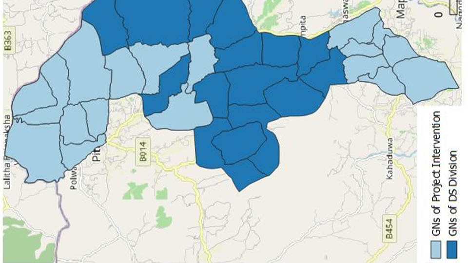
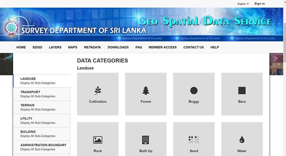
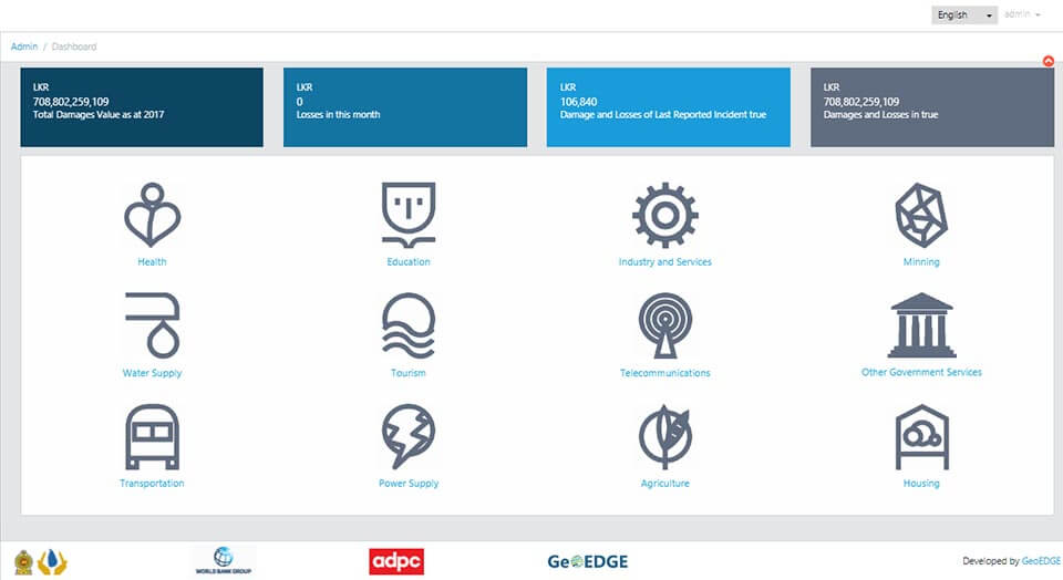
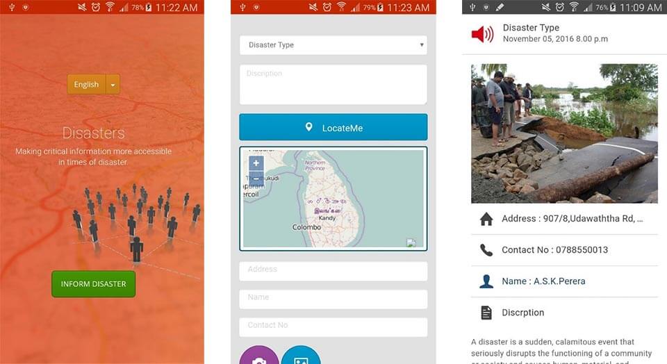
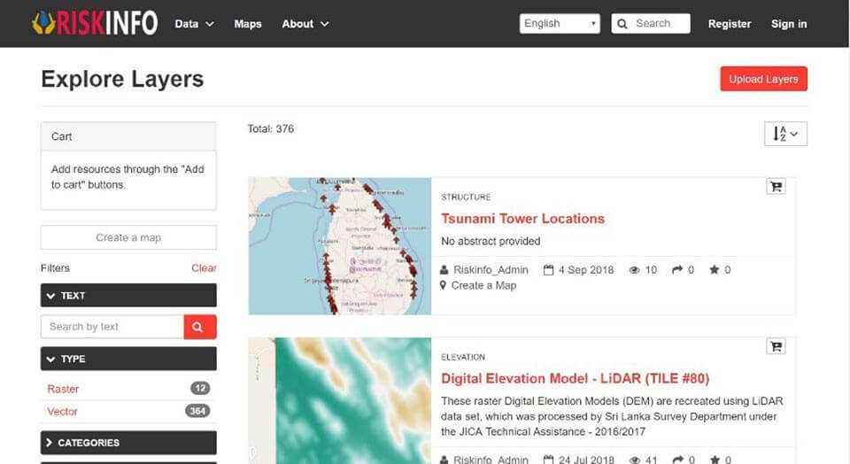
GeoEDGE is a limited liability company, incorporated in July 2014, for providing open source software solutions for Application Development, GIS and Remote Sensing, Mapping and Consultancy Services. Our work aiming to meet the increasing needs in surveying, analysis, mapping, spatial modelling and visualization with geospatial data, and information, expects to provide effective and novel solutions to clients who are looking for end‐to‐end innovative solutions for the improvement of our living environment.
×
Our Work
Services
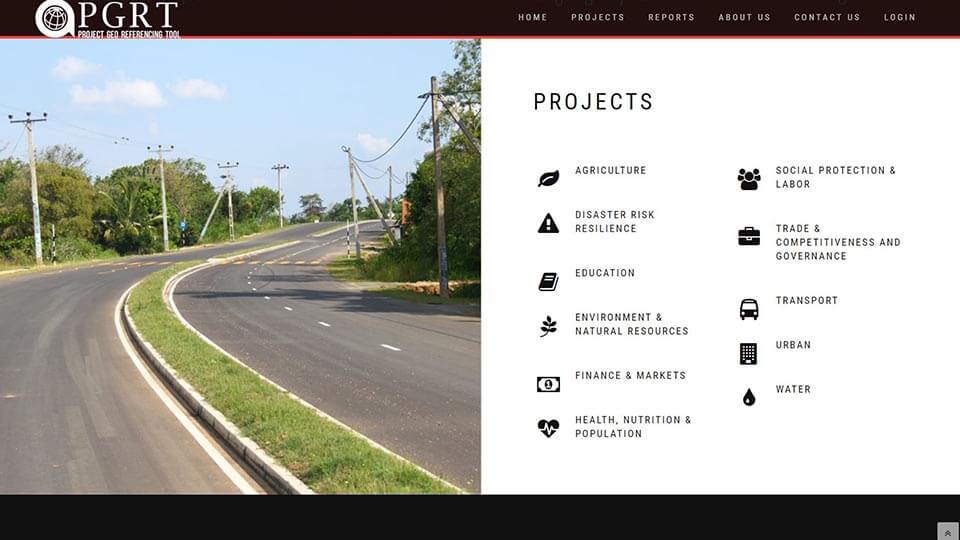
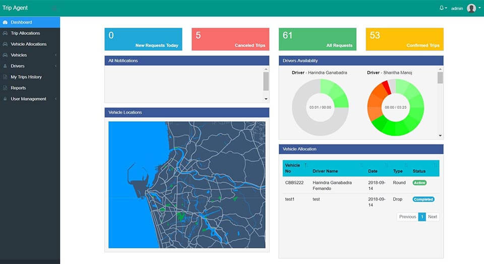
Software Application Development
GIS / Remote Sensing Application Development
Mobile Application Development
GIS / Remote Sensing Services
Consultancy
Training and Development
Video Conferencing Solutions
Image Analysis Solutions
Enterprise Resource Planning (ERP)
Internet Of Things (IOT)
Digital Transformation

function is to collect global and high resolution land observation data.
")
by providing very high resolution optical and SAR images

all global land spaces with 5 meter resolution
GeoEDGEMap Engine - Create your own maps by adding your own data set and perform spatial analysis.
clientele

partners

Contact us